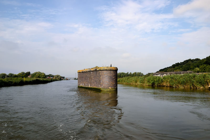
From the moorings at Herringfleet it is just a short distance to the old swing bridge at Haddiscoe. The bridge has long since been dismantled but the central pier remains, keep to the right passed the pier.

On the left is the Environment Agency Haddiscoe Depot. A little further along, on the left, is the New Cut, the turning for the River Yare.
Haddiscoe New Cut
The New Cut is a canal like section dug in 1833, it was constructed to encourage commercial traffic to use the docks at Lowestoft rather than Great Yarmouth. Its purpose being to reduce the distance from the Yare at Reedham to the Waveney at St Olaves, a reduction of seven miles. The tide ebbs and flows from the Yare end. The cut is 2 ½ miles long, the fixed Haddiscoe Bridge has headroom of 24ft at average high water.
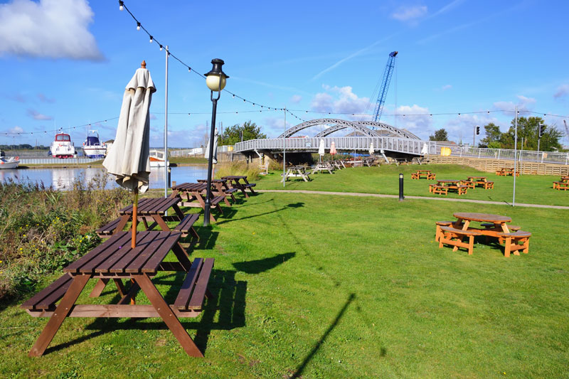
The River Waveney bends around to the right with Johnson’s Yacht Station on the left (Private). Slow down here and check the height gauges for St Olaves Bridge ahead. The bridge has 8ft headroom at average high water. The tide flows very fast here make sure you have lowered your windscreen and canopy in good time.
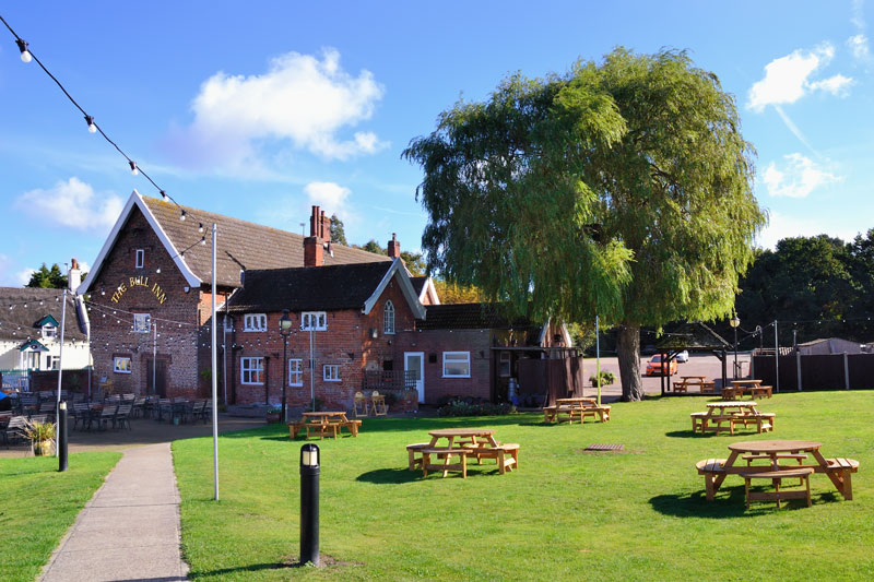
Just before the bridge are the moorings at The Bell Inn. Mooring here with the bridge so close can be tricky. If you have enough room under the bridge it may be prudent to moor at the free Broads Authority St Olaves moorings a little downstream of the bridge. From here it is just a short stroll back to The Bell Inn.
St Olaves
St Olaves is not an unattractive village as first impressions from the river may suggest. The mill beside the moorings is known as Priory or St Olaves Drainage Mill, it has recently been restored after the cap blew off in a storm.
The Bell Inn situated on the river has a delightful garden with views down the Waveney. Alongside the bridge is The Bridge Stores, a chandlery, the store sells basic provisions and also offers day boats for hire.
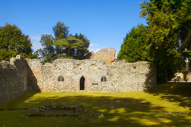
A short walk east along the busy Beccles Road are the ruins of the Augustinian Priory of St Olaves and St Mary, entry is free. Next door to the priory is The Priory Farm Restaurant, the restaurant serves a wide range of dishes including fresh fish. Look out for the Llamas at the entrance too!
If you feel energetic, walk a little further along the main street and visit Fritton Lake and Visitor Centre. The lake is 3 miles long, in a beautiful setting surrounded by trees and parkland. Other attractions there include fishing, golf, pony rides, cafe and adventure playground.
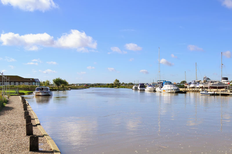
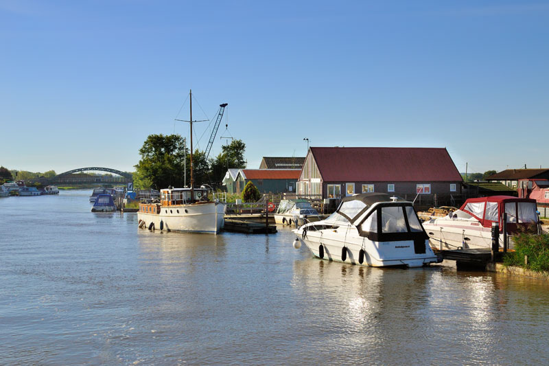
After passing through the bridge, on the left are a number of boatyards and at the end on the right are the Broads Authority St Olaves moorings. As mentioned earlier the tide flows fast here so come into moor against the tide.
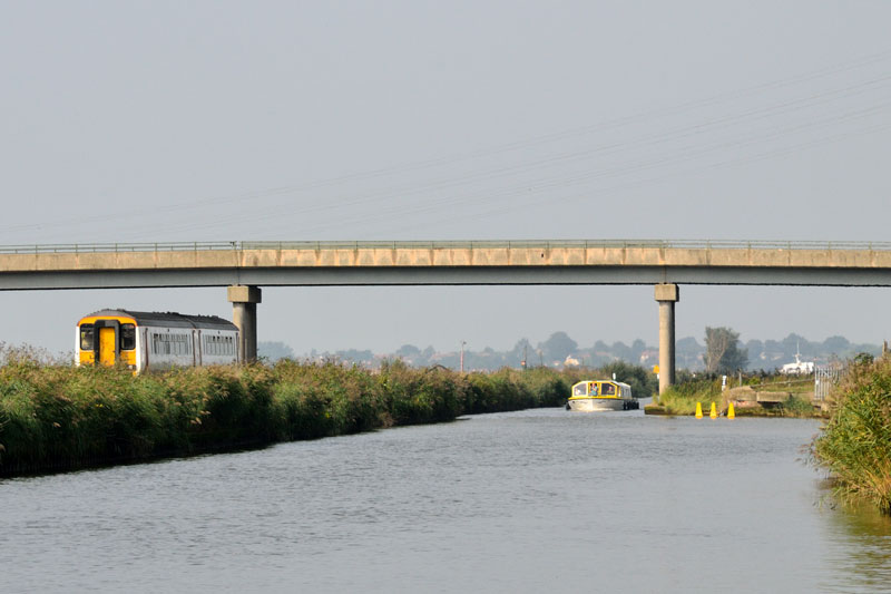
From here the Waveney meanders around Fritton Marshes. Over on the right the wooded ridge that has accompanied the river from Oulton Dyke sweeps down close to the River. Across the reeds where the cables (92ft) cross you may catch sight of boats on the New Cut. The river continues on its way through Chedgrave and Belton Marshes towards Burgh Castle. Keep clear of the bends, as they can be shallow and muddy at low tide.
The river widens slightly as Burgh Castle is reached. The Broads Authority Moorings are on the right bank just before Goodchild Marine.
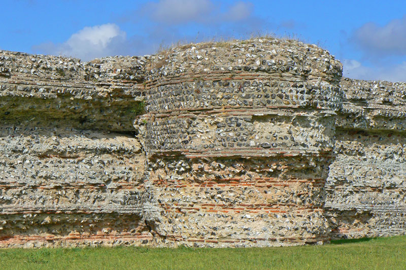
Burgh Castle
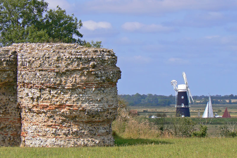
Burgh Castle is an imposing structure, it is one of several Roman forts built as a defence against Saxon raids. The fort is a large rectangle, the walls and bastions on three sides have survived to their full height. The fourth has long since fallen into what was once an estuary, Breydon Water is now all the remains the rest is marshland. The site is rich in bird, animal and plant life with extensive views over Haddiscoe Island towards Berney Arms Mill and beyond. The castle can be reached by following the footpath from the moorings at the Fisherman’s Inn. Entrance to the castle is free at any reasonable time, there are no facilities other than information boards.
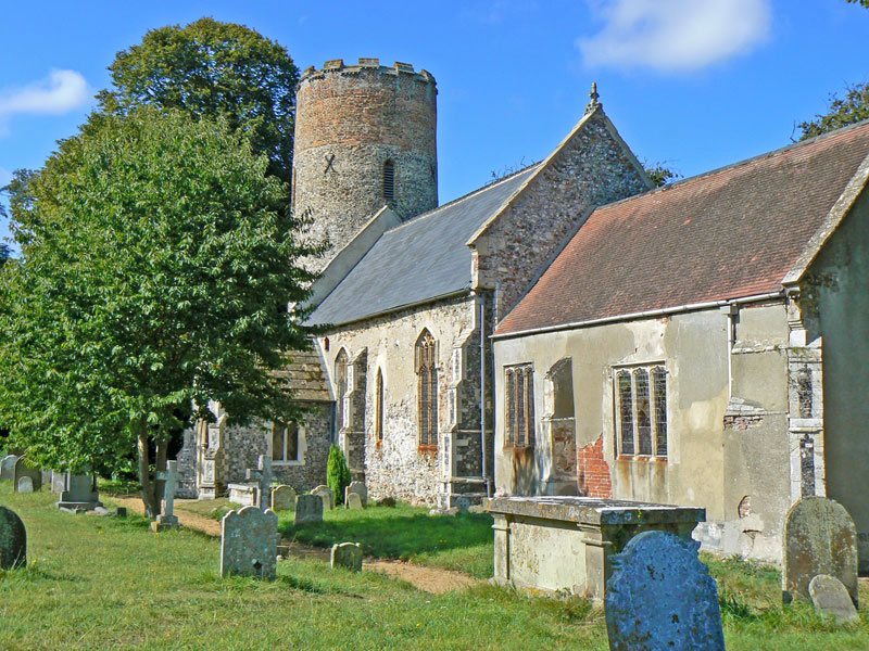
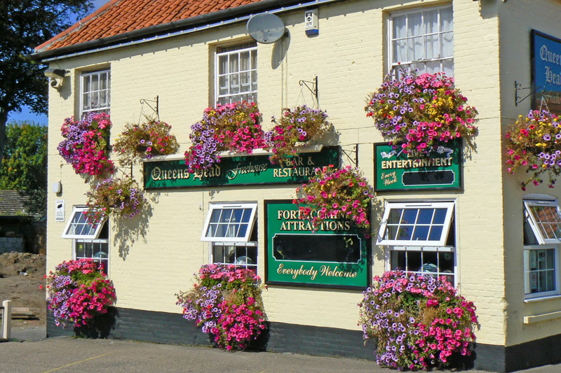
The village of Burgh Castle with it’s attractive church and Queens Head Pub is a few minutes walk past the castle.
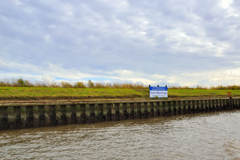
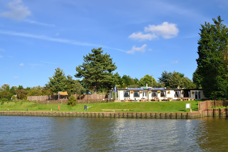
Immediately on the right after Goodchild Marine is the Fisherman’s Inn with moorings available for patrons.
The river widens and posts mark the channel as Breydon Water is reached. On the left is the River Yare, if turning to go up the Yare, turn after the fixed jetty known as the turn-
River Waveney –
River Yare –
River Yare –
Photo credits www.TourNorfolk.co.uk