Oulton Dyke is on the right ½ mile below Burgh St Peter the main river continues to the north through Burgh and Oulton Marshes and on towards Somerleyton.

Oulton Dyke is 1 ¼ miles long mooring is available on the left at the Dutch Tea Gardens, the tearoom closed in the 1950’s. An interesting 2 mile walk can be taken from here around Oulton Marshes. On the right bank there are pontoon moorings at Peto’s Marsh.
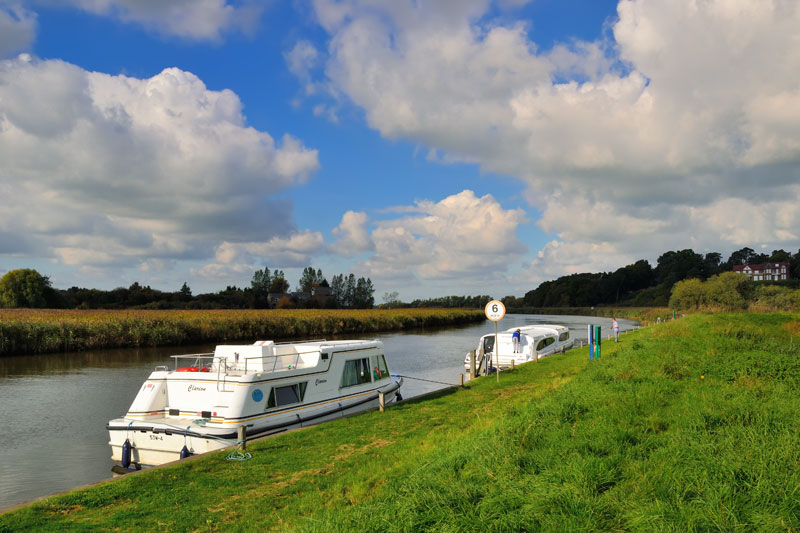
The dyke now makes a sharp turn to the left on the right are two short dykes that can be very shallow at low tide. There is a 5 mph speed limit along the dyke but slow down as you pass the private moorings on the left.
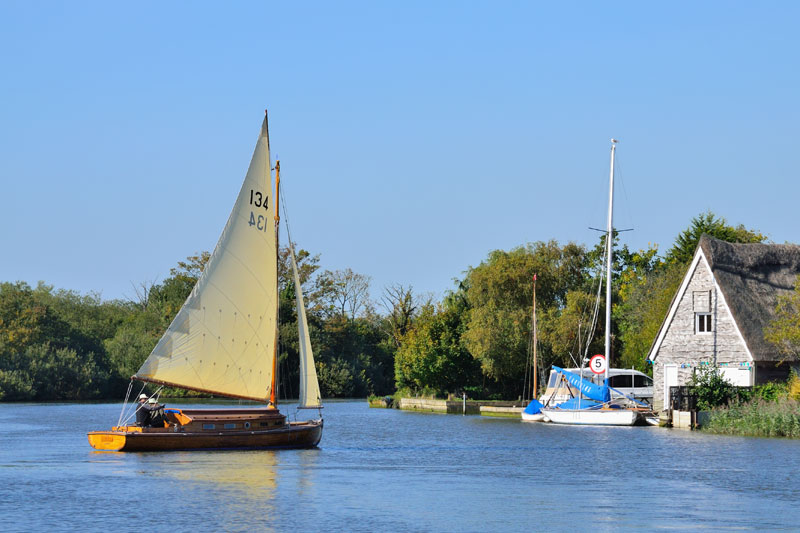
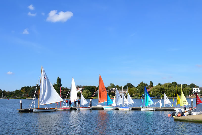
Oulton Broad covers an area of about 0.5 square km. It is popular both for sailing and powerboat racing. Navigation is restricted during the race meetings held on Thursday evening and some weekends during the summer. Follow the directions of the marshals, but failing this navigate along the north bank between the mooring buoys and shore when racing is taking place.
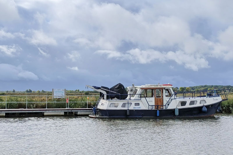
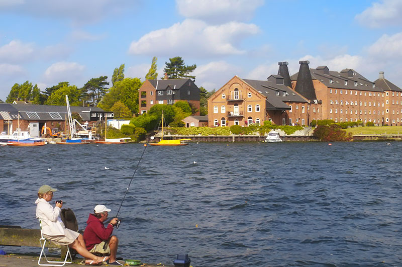
Oulton Broad Yacht Station is on the east side of the broad where there are plentiful moorings, mooring is also allowed mid broad by mud weight.
Oulton Broad
Oulton Broad like at Yarmouth has access to the sea. This is via Mutford Lock and Lake Lothing. The lock marks the limit of navigation for hire craft.
The north side of the broad is one of the most expensive places to live in the area. Large houses with attractive gardens and boathouses sweep down to the edge of the broad. Further over to the east are the converted maltings and old boatyard buildings. The south west corner is quiet and unspoiled. A footpath leads from Nicholas Everitt Park to White Cast Marshes and onto the visitor centre at Carlton Marshes Nature Reserve.
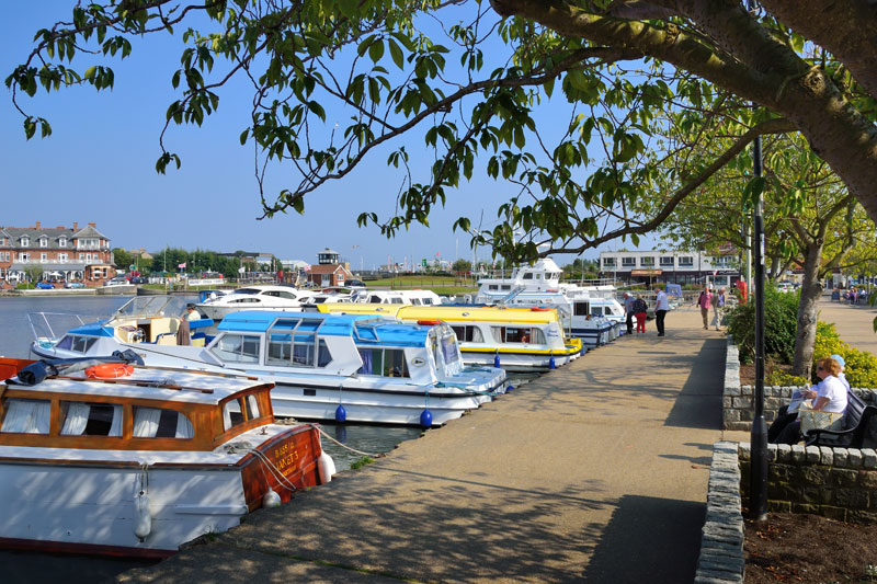
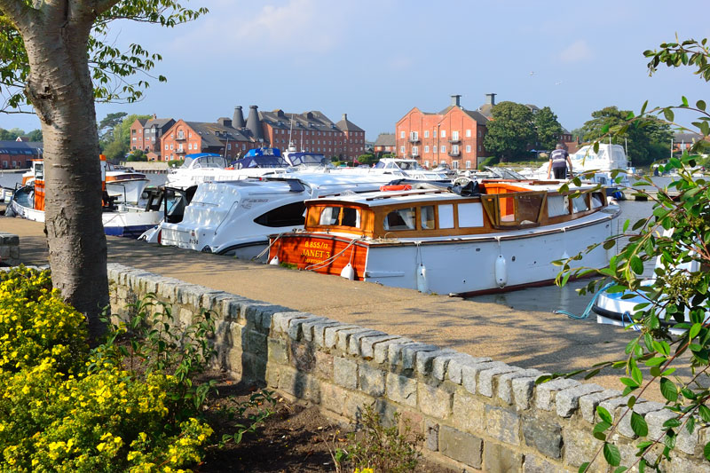
Oulton Broad Yacht Station is here adjacent to Mutford Lock. The yacht station looks out over the broad to the old maltings, now converted to modern apartments. The Harbour Master will help you moor. Next to his office are the toilet, shower and laundry facilities. There are boat trips from Mutford Lock and day boats for hire near the yacht station. The Boulevard Leisure Centre is next to the yacht station and includes a fully licensed free house, family restaurant and amusement arcade. The Wherry Hotel overlooks the broad and is just a short walk from the yacht station.
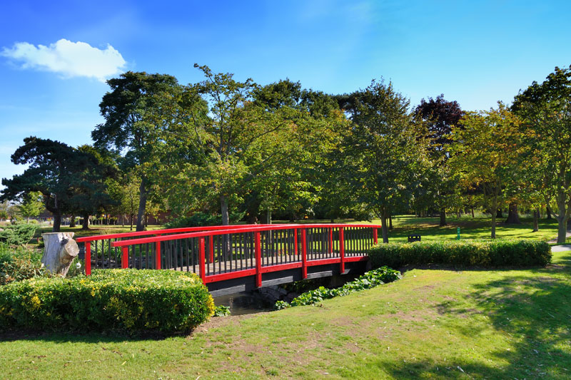
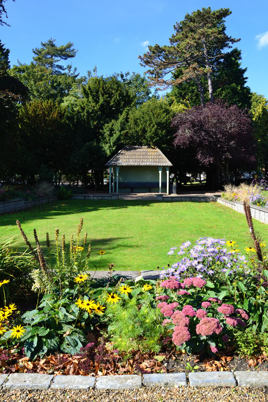
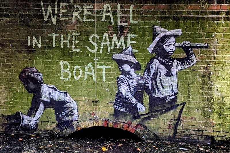
A path leads from the yacht station to Nicholas Everitt Park, the park offers extensive views over Oulton Broad. It is a popular spot on Thursday evenings during the summer as people gather to watch the powerboat racing. The flowerbeds in the gardens here are particularly attractive, the grounds cover an area of about 15 1/2 acres. Have you spotted the Banksy that has recently appeared here? There is also plenty in the park for children, including a paddling pool, crazy golf and trampolines. Refreshments are also available.
The local shops are a short walk from the yacht station. A new Nisa Local convenience store has opened on Bridge Road just around the corner from the yacht station. It is open from 7am until late.
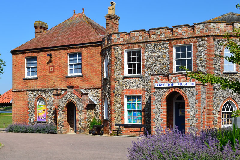
Lowestoft Museum is situated at the back of the yacht station in Broad House a grade ll listed building dating from 1685. The museum is open daily from 1pm until 4pm. Over the far side of the broad is the recently refurbished Wherry Hotel. Their moorings (fee) have an uninterrupted view over Oulton Broad.
The main river gently meanders towards Somerleyton. There is a water ski zone between Oulton Dyke and Somerleyton, beware of the wash caused by the speed boats as they pass by.
Over on the right is the railway run by Wherry Lines. The track crosses the River Waveney at Somerleyton and accompanies the river to St Olaves where it runs adjacent to the New Cut up to Reedham.
The hills on the right are an attractive feature of the landscape here and run all the way to Burgh Castle. There are a number of informal moorings places on this section of the river but be mindful of the rise and fall of the tide, especially after heavy rain.
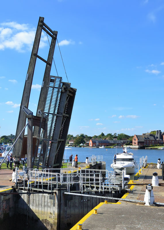
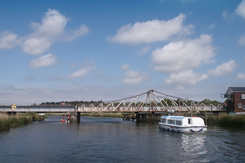
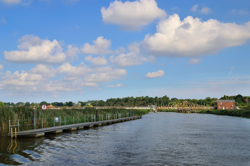
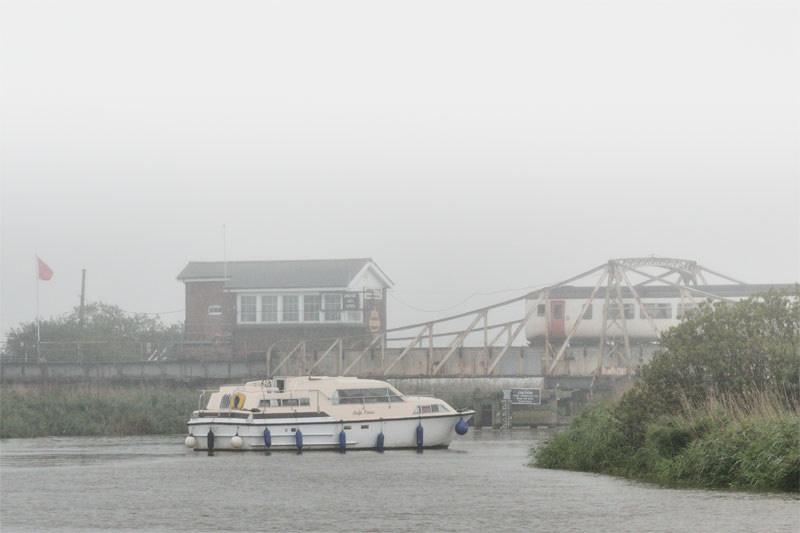
3 miles below Oulton Dyke is Somerleyton Swing Bridge. The bridge was built in 1905 and requires regular maintenance. It is a requirement in law that the bridge opens to allow the passage of river traffic. The bridge has a clearance of 8 ft 6 in at average high water. On the left before the bridge are some pontoon moorings. These are reserved for craft waiting for the bridge to open. To request a bridge opening call on VHF Ch12 or give three long blasts on the horn. There may be a wait of up to 20 minutes for trains to clear the area. If two red flags are flying then unfortunately the bridge is inoperable.
On the right after the bridge is the entrance to a private marina and beyond the Somerleyton BA Moorings. The tide is apt to flow fast here with quite a bit of wind coming off the marshes so care is needed.
Somerleyton
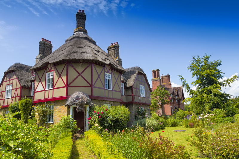
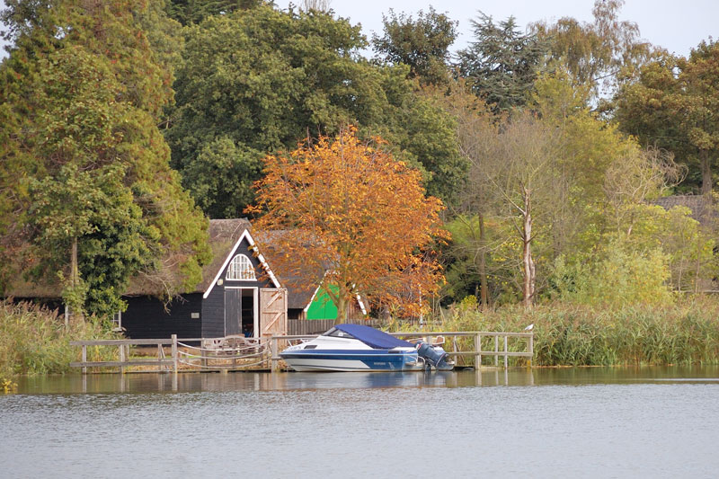
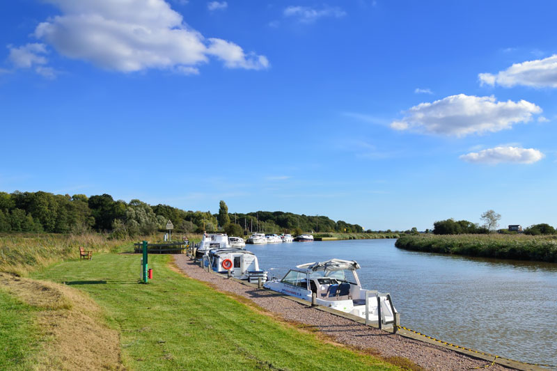
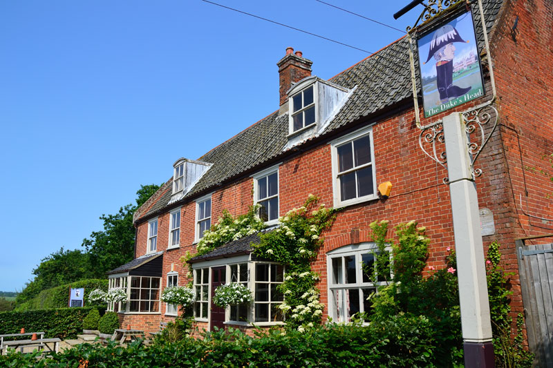
The attractive village of Somerleyton with its thatched cottages, village green and pond is a short walk from the staithe. Further away but still within walking distance is Somerleyton Hall and Gardens. The gardens include a Yew hedge maze that will interest children of all ages. The red bricked Dukes Head is a few minutes walk along Staithe Lane and serves food sourced locally and Suffolk real ales. The pub has a attractive beer garden with a small children’s play area. There is a good view of Somerleyton Swing Bridge from the southern most section of the Broads Authority Moorings.
The river continues through Herringfleet Marshes. The marshes stretch from Somerleyton to St Olaves and are overlooked by Herringfleet Hills, part of the Somerleyton Estate. Recently the hills have been classed as open country as defined under the CRoW Act. Together with the Broads Authority the estate has opened up the area to walkers and provided a car park and way marked paths leading to Herringfleet Smock Mill.
Herringfleet Smock Mill
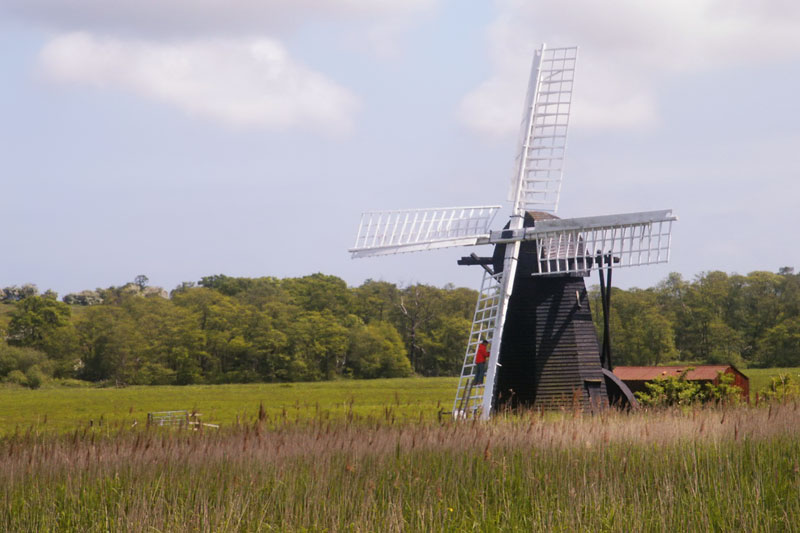
Herringfleet Smock Mill is of wooden construction and was built to drain the marshes. It was built in the 1800’s and was used up until the 1950’s it is the last remaining mill of its type on the Broads. The sails can be moved into the wind by hand using the tail pole and winch. The scoop wheel housed outside the mill would pass the water from the dyke and empty it into the river. The mill can still pump up to 2000 gallons a minute in a stiff breeze. A steam driven pump later replaced it and now an electric pump provides drainage for the surrounding marshes.
The mill can be see in operation wind permitting during National Mills Weekend held in early May and on occasional Sundays during the summer months.
On the right bank a little down stream is Herringfleet Broads Authority 24 hour moorings.