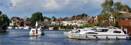
Broads River Distance Chart
The Norfolk Broads river distance charts below indicate the distance in miles between various locations on the Broads. Separate distance tables for the upper and lower sections of each of the Broads Rivers is featured including a distance table for travelling from the Northern Broads to the Southern Broads or vice versa. With large distance charts it is possible to loose your place when scrolling. This Broads distance calculator is responsive and should be easily viewable on all devices.

Broads River Distances – River Bure (Upper)
Coltishall
| Coltishall | 0 |
| Belaugh | 2.25 |
| Wroxham | 6 |
| Salhouse Broad | 8.75 |
| Horning | 10.75 |
| Horning Ferry | 11.75 |
| Ranworth | 13.75 |
| Ant Mouth | 14.5 |
| St Benet’s | 14.75 |
| South Walsham Broad | 16 |
| Thurne Mouth | 16.75 |
| Acle | 19.5 |
| Stokesby | 21.5 |
| Stracey Arms | 22.75 |
| Yarmouth | 30.75 |
Wroxham
| Coltishall | 6 |
| Belaugh | 3.75 |
| Wroxham | 0 |
| Salhouse Broad | 2.75 |
| Horning | 4.75 |
| Horning Ferry | 5.75 |
| Ranworth | 7.75 |
| Ant Mouth | 8.5 |
| St Benet’s | 8.75 |
| South Walsham Broad | 10 |
| Thurne Mouth | 10.75 |
| Acle | 13.5 |
| Stokesby | 15.5 |
| Stracey Arms | 16.75 |
| Yarmouth | 24.75 |
Salhouse Broad
| Coltishall | 8.75 |
| Belaugh | 6.5 |
| Wroxham | 2.75 |
| Salhouse Broad | 0 |
| Horning | 2 |
| Horning Ferry | 3 |
| Ranworth | 5 |
| Ant Mouth | 5.75 |
| St Benet’s | 6 |
| South Walsham Broad | 7.25 |
| Thurne Mouth | 8 |
| Acle | 10.75 |
| Stokesby | 12.75 |
| Stracey Arms | 14 |
| Yarmouth | 22 |
Horning
| Coltishall | 10.75 |
| Belaugh | 8.5 |
| Wroxham | 4.75 |
| Salhouse Broad | 2 |
| Horning | 0 |
| Horning Ferry | 1 |
| Ranworth | 3 |
| Ant Mouth | 3.75 |
| St Benet’s | 4 |
| South Walsham Broad | 5.75 |
| Thurne Mouth | 6 |
| Acle | 8.75 |
| Stokesby | 10.75 |
| Stracey Arms | 12 |
| Yarmouth | 20 |
Ranworth
| Coltishall | 13.75 |
| Belaugh | 11.5 |
| Wroxham | 7.75 |
| Salhouse Broad | 5 |
| Horning | 2.75 |
| Horning Ferry | 1.75 |
| Ranworth | 0 |
| Ant Mouth | 1.25 |
| St Benet’s | 1.5 |
| South Walsham Broad | 2.75 |
| Thurne Mouth | 3.25 |
| Acle | 6.25 |
| Stokesby | 8.25 |
| Stracey Arms | 9.25 |
| Yarmouth | 17.5 |
Ant Mouth
| Coltishall | 14.5 |
| Belaugh | 12.25 |
| Wroxham | 8.5 |
| Salhouse Broad | 5.75 |
| Horning | 3.75 |
| Horning Ferry | 2.75 |
| Ranworth | 1.25 |
| Ant Mouth | 0 |
| St Benet’s | 0.25 |
| South Walsham Broad | 1.5 |
| Thurne Mouth | 2.25 |
| Acle | 5 |
| Stokesby | 7 |
| Stracey Arms | 8.25 |
| Yarmouth | 16.25 |
Broads River Distances – River Bure (Lower)
South Walsham Broad
| Coltishall | 16 |
| Belaugh | 13.75 |
| Wroxham | 10 |
| Salhouse Broad | 7.25 |
| Horning | 5.25 |
| Horning Ferry | 4.25 |
| Ranworth | 2.75 |
| Ant Mouth | 1.5 |
| St Benet’s | 1 |
| South Walsham Broad | 0 |
| Thurne Mouth | 2.75 |
| Acle | 5.5 |
| Stokesby | 7.5 |
| Stracey Arms | 8.75 |
| Yarmouth | 16.75 |
Thurne Mouth
| Coltishall | 16.75 |
| Belaugh | 14.5 |
| Wroxham | 10.75 |
| Salhouse Broad | 8 |
| Horning | 6 |
| Horning Ferry | 5 |
| Ranworth | 3.25 |
| Ant Mouth | 2.25 |
| St Benet’s | 1.75 |
| South Walsham Broad | 2.75 |
| Thurne Mouth | 0 |
| Acle | 2.75 |
| Stokesby | 4.75 |
| Stracey Arms | 6 |
| Yarmouth | 14 |
Acle
| Coltishall | 19.5 |
| Belaugh | 17.25 |
| Wroxham | 13.5 |
| Salhouse Broad | 10.75 |
| Horning | 8.75 |
| Horning Ferry | 7.75 |
| Ranworth | 6.25 |
| Ant Mouth | 5 |
| St Benet’s | 4.5 |
| South Walsham Broad | 5.5 |
| Thurne Mouth | 2.75 |
| Acle | 0 |
| Stokesby | 2 |
| Stracey Arms | 3.25 |
| Yarmouth | 11.25 |
Stokesby
| Coltishall | 21.5 |
| Belaugh | 19.25 |
| Wroxham | 15.5 |
| Salhouse Broad | 12.75 |
| Horning | 10.75 |
| Horning Ferry | 9.75 |
| Ranworth | 8.25 |
| Ant Mouth | 7 |
| St Benet’s | 6.5 |
| South Walsham Broad | 7.5 |
| Thurne Mouth | 4.75 |
| Acle | 2 |
| Stokesby | 0 |
| Stracey Arms | 1.25 |
| Yarmouth | 9.25 |
Stracey Arms
| Coltishall | 22.75 |
| Belaugh | 20.5 |
| Wroxham | 16.75 |
| Salhouse Broad | 14 |
| Horning | 12 |
| Horning Ferry | 11 |
| Ranworth | 9.25 |
| Ant Mouth | 8.25 |
| St Benet’s | 7.75 |
| South Walsham Broad | 8.75 |
| Thurne Mouth | 6 |
| Acle | 3.25 |
| Stokesby | 1.25 |
| Stracey Arms | 0 |
| Yarmouth | 8 |
Yarmouth
| Coltishall | 30.75 |
| Belaugh | 28.5 |
| Wroxham | 24.75 |
| Salhouse Broad | 22 |
| Horning | 20 |
| Horning Ferry | 19 |
| Ranworth | 17.5 |
| Ant Mouth | 16.25 |
| St Benet’s | 15.75 |
| South Walsham Broad | 16.75 |
| Thurne Mouth | 14 |
| Acle | 11.25 |
| Stokesby | 9.25 |
| Stracey Arms | 8 |
| Yarmouth | 0 |
| Berney Arms | 3.75 |
| Burgh Castle | 4.5 |
Broads River Distances – River Ant (Upper)
Dilham
| Dilham | 0 |
| Wayford Bridge | 1 |
| Stalham | 3.5 |
| Sutton | 3.5 |
| Barton Turf | 3.25 |
| Neatishead | 4.75 |
| Irstead | 4.75 |
| How Hill | 5.75 |
| Ludham Bridge | 8 |
| Ant Mouth | 8.75 |
Wayford Bridge
| Dilham | 1 |
| Wayford Bridge | 0 |
| Stalham | 2.5 |
| Sutton | 2.5 |
| Barton Turf | 2.25 |
| Neatishead | 3.75 |
| Irstead | 3.75 |
| How Hill | 4.75 |
| Ludham Bridge | 7 |
| Ant Mouth | 7.75 |
Stalham
| Dilham | 3.5 |
| Wayford Bridge | 2.5 |
| Stalham | 0 |
| Sutton | 1.5 |
| Barton Turf | 1.75 |
| Neatishead | 3.25 |
| Irstead | 3.25 |
| How Hill | 4.25 |
| Ludham Bridge | 6.5 |
| Ant Mouth | 7.25 |
Sutton
| Dilham | 3.5 |
| Wayford Bridge | 2.5 |
| Stalham | 1.5 |
| Sutton | 0 |
| Barton Turf | 1.75 |
| Neatishead | 3.25 |
| Irstead | 3.25 |
| How Hill | 4.25 |
| Ludham Bridge | 6.5 |
| Ant Mouth | 7.25 |
Barton Turf
| Dilham | 3.25 |
| Wayford Bridge | 2.25 |
| Stalham | 1.75 |
| Sutton | 1.75 |
| Barton Turf | 0 |
| Neatishead | 1.75 |
| Irstead | 1.75 |
| How Hill | 2.75 |
| Ludham Bridge | 5 |
| Ant Mouth | 5.75 |
Barton Broad North
| Dilham | 3.25 |
| Wayford Bridge | 2.25 |
| Stalham | 1.75 |
| Sutton | 1.75 |
| Barton Turf | 0.25 |
| Neatishead | 1.5 |
| Irstead | 1.5 |
| How Hill | 2.5 |
| Ludham Bridge | 4.75 |
| Ant Mouth | 5.5 |
Broads River Distances – River Ant (Lower)
Neatishead
| Dilham | 4.75 |
| Wayford Bridge | 3.75 |
| Stalham | 3.25 |
| Sutton | 3.25 |
| Barton Turf | 1.75 |
| Neatishead | 0 |
| Irstead | 1.75 |
| How Hill | 2.25 |
| Ludham Bridge | 5 |
| Ant Mouth | 5.75 |
Barton Broad Mouth
| Dilham | 4.25 |
| Wayford Bridge | 3.25 |
| Stalham | 2.75 |
| Sutton | 2.75 |
| Barton Turf | 1.25 |
| Neatishead | 1.25 |
| Irstead | 0.5 |
| How Hill | 1.5 |
| Ludham Bridge | 3.75 |
| Ant Mouth | 4.5 |
Irstead
| Dilham | 4.75 |
| Wayford Bridge | 3.75 |
| Stalham | 3.25 |
| Sutton | 3.25 |
| Barton Turf | 1.75 |
| Neatishead | 1.75 |
| Irstead | 0 |
| How Hill | 1 |
| Ludham Bridge | 3.25 |
| Ant Mouth | 4 |
How Hill
| Dilham | 5.75 |
| Wayford Bridge | 4.75 |
| Stalham | 4.25 |
| Sutton | 4.25 |
| Barton Turf | 2.75 |
| Neatishead | 2.25 |
| Irstead | 1 |
| How Hill | 0 |
| Ludham Bridge | 2.25 |
| Ant Mouth | 3 |
Ludham Bridge
| Dilham | 8 |
| Wayford Bridge | 7 |
| Stalham | 6.5 |
| Sutton | 6.5 |
| Barton Turf | 5 |
| Neatishead | 5 |
| Irstead | 3.25 |
| How Hill | 2.25 |
| Ludham Bridge | 0 |
| Ant Mouth | 0.75 |
Ant Mouth
| Dilham | 8.75 |
| Wayford Bridge | 7.75 |
| Stalham | 7.25 |
| Sutton | 7.25 |
| Barton Turf | 5.75 |
| Neatishead | 5.75 |
| Irstead | 4 |
| How Hill | 3 |
| Ludham Bridge | 0.75 |
| Ant Mouth | 0 |
Broads River Distances – River Thurne (Upper)
West Somerton
| West Somerton | 0 |
| Candle Dyke | 1.75 |
| Meadow Dyke | 3 |
| Horsey | 4.75 |
| Hickling | 4.75 |
| Potter Heigham | 3.25 |
| Womack Water | 6 |
| Thurne Dyke | 6 |
| Thurne Mouth | 6.5 |
Horsey
| West Somerton | 4.75 |
| Candle Dyke | 3 |
| Meadow Dyke | 1.75 |
| Horsey | 0 |
| Hickling | 3.75 |
| Potter Heigham | 4.5 |
| Womack Water | 7 |
| Thurne Dyke | 7 |
| Thurne Mouth | 7.5 |
Catfield Staithe
| West Somerton | 5 |
| Candle Dyke | 3.25 |
| Meadow Dyke | 2.25 |
| Horsey | 4 |
| Hickling | 1.5 |
| Potter Heigham | 4.75 |
| Womack Water | 7.25 |
| Thurne Dyke | 7.25 |
| Thurne Mouth | 7.75 |
Hickling
| West Somerton | 4.75 |
| Candle Dyke | 3 |
| Meadow Dyke | 2 |
| Horsey | 3.75 |
| Hickling | 0 |
| Potter Heigham | 4.5 |
| Womack Water | 7 |
| Thurne Dyke | 7 |
| Thurne Mouth | 7.5 |
Potter Heigham
| West Somerton | 3.25 |
| Candle Dyke | 1.5 |
| Meadow Dyke | 2.75 |
| Horsey | 4.5 |
| Hickling | 4.5 |
| Potter Heigham | 0 |
| Womack Water | 2.5 |
| Thurne Dyke | 2.5 |
| Thurne Mouth | 3 |
Broads River Distances – River Thurne (Lower)
Womack Water
| West Somerton | 6 |
| Candle Dyke | 4 |
| Meadow Dyke | 5.25 |
| Horsey | 7 |
| Hickling | 7 |
| Potter Heigham | 2.5 |
| Womack Water | 0 |
| Thurne Dyke | 1.5 |
| Thurne Mouth | 2 |
Thurne Dyke
| West Somerton | 6 |
| Candle Dyke | 4 |
| Meadow Dyke | 5.25 |
| Horsey | 7 |
| Hickling | 7 |
| Potter Heigham | 2.5 |
| Womack Water | 2 |
| Thurne Dyke | 0 |
| Thurne Mouth | 0.5 |
Thurne Mouth
| West Somerton | 6.5 |
| Candle Dyke | 4.5 |
| Meadow Dyke | 5.75 |
| Horsey | 7.5 |
| Hickling | 7.5 |
| Potter Heigham | 3 |
| Womack Water | 2.5 |
| Thurne Dyke | 0.5 |
| Thurne Mouth | 0 |
Broads River Distances – River Yare (Upper)
Norwich
| Norwich Yacht Station | 0 |
| Thorpe St Andrew | 2 |
| Bramerton Common | 5 |
| Surlingham Ferry | 6.75 |
| Brundall | 8.5 |
| Rockland Staithe | 11.25 |
| Buckenham Ferry | 11.5 |
| Langley Dyke | 13.25 |
| Cantley | 14.5 |
| Hardley Cross | 16.75 |
| Loddon (River Chet) | 20.25 |
| Reedham | 18.25 |
| Berney Arms | 23.25 |
| Yarmouth | 27 |
Thorpe
| Norwich Yacht Station | 2 |
| Thorpe St Andrew | 0 |
| Bramerton Common | 3 |
| Surlingham Ferry | 4.75 |
| Brundall | 6.5 |
| Rockland Staithe | 9.25 |
| Buckenham Ferry | 9.5 |
| Langley Dyke | 11.25 |
| Cantley | 12.5 |
| Hardley Cross | 14.75 |
| Loddon (River Chet) | 18.25 |
| Reedham | 16.25 |
| Berney Arms | 21.25 |
| Yarmouth | 25 |
Bramerton
| Norwich Yacht Station | 5 |
| Thorpe St Andrew | 3 |
| Bramerton Common | 0 |
| Surlingham Ferry | 1.75 |
| Brundall | 3.5 |
| Rockland Staithe | 6.25 |
| Buckenham Ferry | 6.5 |
| Langley Dyke | 8.25 |
| Cantley | 9.5 |
| Hardley Cross | 11.75 |
| Loddon (River Chet) | 15.25 |
| Reedham | 13.25 |
| Berney Arms | 18.25 |
| Yarmouth | 22 |
Surlingham
| Norwich Yacht Station | 6.75 |
| Thorpe St Andrew | 4.75 |
| Bramerton Common | 1.75 |
| Surlingham Ferry | 0 |
| Brundall | 1.75 |
| Rockland Staithe | 4.5 |
| Buckenham Ferry | 4.75 |
| Langley Dyke | 6.5 |
| Cantley | 7.75 |
| Hardley Cross | 10 |
| Loddon (River Chet) | 13.5 |
| Reedham | 11.5 |
| Berney Arms | 16.5 |
| Yarmouth | 20.25 |
Brundall
| Norwich Yacht Station | 8.5 |
| Thorpe St Andrew | 6.5 |
| Bramerton Common | 3.5 |
| Surlingham Ferry | 1.75 |
| Brundall | 0 |
| Rockland Staithe | 2.75 |
| Buckenham Ferry | 3 |
| Langley Dyke | 4.75 |
| Cantley | 6 |
| Hardley Cross | 8.25 |
| Loddon (River Chet) | 11.75 |
| Reedham | 9.75 |
| Berney Arms | 14.75 |
| Yarmouth | 18.5 |
Rockland
| Norwich Yacht Station | 11.25 |
| Thorpe St Andrew | 9.25 |
| Bramerton Common | 6.25 |
| Surlingham Ferry | 4.5 |
| Brundall | 2.75 |
| Rockland Staithe | 0 |
| Buckenham Ferry | 2.25 |
| Langley Dyke | 4 |
| Cantley | 5.25 |
| Hardley Cross | 7.5 |
| Loddon (River Chet) | 11 |
| Reedham | 8.75 |
| Berney Arms | 14 |
| Yarmouth | 17.75 |
Langley Dyke
| Norwich Yacht Station | 13.25 |
| Thorpe St Andrew | 11.25 |
| Bramerton Common | 8.25 |
| Surlingham Ferry | 6.5 |
| Brundall | 4.75 |
| Rockland Staithe | 4 |
| Buckenham Ferry | 1.75 |
| Langley Dyke | 0 |
| Cantley | 1.25 |
| Hardley Cross | 3.5 |
| Loddon (River Chet) | 7 |
| Reedham | 5 |
| Berney Arms | 10 |
| Yarmouth | 13.75 |
Broads River Distances – River Yare (Lower)
Cantley
| Norwich Yacht Station | 14.5 |
| Thorpe St Andrew | 12.5 |
| Bramerton Common | 9.5 |
| Surlingham Ferry | 7.75 |
| Brundall | 6 |
| Rockland Staithe | 5.25 |
| Buckenham Ferry | 3 |
| Langley Dyke | 1.25 |
| Cantley | 0 |
| Hardley Cross | 2.25 |
| Loddon (River Chet) | 5.75 |
| Reedham | 3.75 |
| Berney Arms | 8.75 |
| Yarmouth | 12.5 |
Hardley Cross
| Norwich Yacht Station | 16.75 |
| Thorpe St Andrew | 14.75 |
| Bramerton Common | 11.75 |
| Surlingham Ferry | 10 |
| Brundall | 8.25 |
| Rockland Staithe | 7.5 |
| Buckenham Ferry | 5.25 |
| Langley Dyke | 3.5 |
| Cantley | 2.25 |
| Hardley Cross | 0 |
| Loddon (River Chet) | 3.5 |
| Reedham | 1.5 |
| Berney Arms | 6.5 |
| Yarmouth | 10.25 |
Loddon
| Norwich Yacht Station | 20.25 |
| Thorpe St Andrew | 18.25 |
| Bramerton Common | 15.25 |
| Surlingham Ferry | 13.5 |
| Brundall | 11.75 |
| Rockland Staithe | 11 |
| Buckenham Ferry | 8.75 |
| Langley Dyke | 6 |
| Cantley | 5.75 |
| Hardley Cross | 3.5 |
| Loddon (River Chet) | 0 |
| Reedham | 5 |
| Berney Arms | 10 |
| Yarmouth | 13.75 |
Reedham
| Norwich Yacht Station | 18.25 |
| Thorpe St Andrew | 16.25 |
| Bramerton Common | 13.25 |
| Surlingham Ferry | 11.5 |
| Brundall | 9.75 |
| Rockland Staithe | 9 |
| Buckenham Ferry | 6.75 |
| Langley Dyke | 5 |
| Cantley | 3.75 |
| Hardley Cross | 1.5 |
| Loddon (River Chet) | 5 |
| Reedham | 0 |
| Berney Arms | 5 |
| Yarmouth | 8.75 |
Berney Arms
| Norwich Yacht Station | 23.25 |
| Thorpe St Andrew | 21.25 |
| Bramerton Common | 18.25 |
| Surlingham Ferry | 16.5 |
| Brundall | 14.75 |
| Rockland Staithe | 14 |
| Buckenham Ferry | 11.75 |
| Langley Dyke | 10 |
| Cantley | 8.75 |
| Hardley Cross | 6.5 |
| Loddon (River Chet) | 10 |
| Reedham | 5 |
| Berney Arms | 0 |
| Yarmouth | 3.75 |
Yarmouth
| Norwich Yacht Station | 27 |
| Thorpe St Andrew | 25 |
| Bramerton Common | 22 |
| Surlingham Ferry | 20.25 |
| Brundall | 18.5 |
| Rockland Staithe | 17.75 |
| Buckenham Ferry | 15.5 |
| Langley Dyke | 13.75 |
| Cantley | 12.5 |
| Hardley Cross | 10.25 |
| Loddon (River Chet) | 13.75 |
| Reedham | 8.75 |
| Berney Arms | 3.75 |
| Yarmouth | 0 |
Broads River Distances – River Waveney (Lower)
Burgh Castle
| Yarmouth | 4.5 |
| Burgh Castle | 0 |
| St Olaves | 4.5 |
| Somerleyton | 6.5 |
| Oulton Dyke | 9.5 |
| Burgh St Peter | 10.25 |
| Oulton Broad | 11.5 |
| Beccles | 17 |
| Geldeston Lock | 20.5 |
St Olaves
| Burgh Castle | 4.5 |
| St Olaves | 0 |
| Somerleyton | 2 |
| Oulton Dyke | 5 |
| Burgh St Peter | 5.75 |
| Oulton Broad | 7 |
| Beccles | 12.5 |
| Geldeston Lock | 16 |
Somerleyton
| Burgh Castle | 6.5 |
| St Olaves | 2 |
| Somerleyton | 0 |
| Oulton Dyke | 3 |
| Burgh St Peter | 3.75 |
| Oulton Broad | 5 |
| Beccles | 10.5 |
| Geldeston Lock | 14 |
Oulton Dyke
| Burgh Castle | 9.5 |
| St Olaves | 5 |
| Somerleyton | 3 |
| Oulton Dyke | 0 |
| Burgh St Peter | 0.75 |
| Oulton Broad | 2 |
| Beccles | 7.5 |
| Geldeston Lock | 11 |
Oulton Broad
| Burgh Castle | 11.5 |
| St Olaves | 7 |
| Somerleyton | 5 |
| Oulton Dyke | 2 |
| Burgh St Peter | 2.75 |
| Oulton Broad | 0 |
| Beccles | 9.5 |
| Geldeston Lock | 13 |
Broads River Distances – River Waveney (Upper)
Burgh St Peter
| Burgh Castle | 10.25 |
| St Olaves | 5.75 |
| Somerleyton | 3.75 |
| Oulton Dyke | 0.75 |
| Burgh St Peter | 0 |
| Oulton Broad | 2.75 |
| Beccles | 6.75 |
| Geldeston Lock | 10.25 |
Beccles
| Burgh Castle | 17 |
| St Olaves | 12.5 |
| Somerleyton | 10.5 |
| Oulton Dyke | 7.5 |
| Burgh St Peter | 6.75 |
| Oulton Broad | 9.5 |
| Beccles | 0 |
| Geldeston Lock | 3.5 |
Geldeston Lock
| Burgh Castle | 20.5 |
| St Olaves | 16 |
| Somerleyton | 14 |
| Oulton Dyke | 11 |
| Burgh St Peter | 10.25 |
| Oulton Broad | 13 |
| Beccles | 3.5 |
| Geldeston Lock | 0 |
Broads River Distances North – South – South – North
Stokesby
| Wroxham | 16.25 |
| Horning | 11.5 |
| Stalham | 15 |
| Potter Heigham | 8 |
| Acle | 2 |
| Stokesby | 0 |
| Stracey Arms | 1.25 |
| Thorpe St Andrew | 34 |
| Brundall | 28 |
| Loddon | 22.75 |
| Reedham | 18.5 |
| Berney Arms | 12.75 |
| St Olaves | 18.25 |
| Burgh Castle | 13.75 |
| Yarmouth | 9.25 |
Reedham
| Wroxham | 33.5 |
| Horning | 28.75 |
| Stalham | 32.75 |
| Potter Heigham | 25.75 |
| Acle | 20 |
| Stokesby | 18.5 |
| Stracey Arms | 16.75 |
| Thorpe St Andrew | 16.5 |
| Brundall | 9.75 |
| Loddon | 5 |
| Reedham | 0 |
| Berney Arms | 5 |
| St Olaves | 3.75 |
| Burgh Castle | 5.75 |
| Yarmouth | 8.75 |
St Olaves
| Wroxham | 34.75 |
| Horning | 30 |
| Stalham | 33.25 |
| Potter Heigham | 26.5 |
| Acle | 20.5 |
| Stokesby | 18.5 |
| Stracey Arms | 17.25 |
| Thorpe St Andrew | 19.75 |
| Brundall | 13.25 |
| Loddon | 8.75 |
| Reedham | 3.75 |
| Berney Arms | 5.25 |
| St Olaves | 0 |
| Burgh Castle | 4.5 |
| Yarmouth | 9.5 |
Yarmouth
| Wroxham | 25.25 |
| Horning | 20.5 |
| Stalham | 24 |
| Potter Heigham | 17 |
| Acle | 11 |
| Stokesby | 9.25 |
| Stracey Arms | 8 |
| Thorpe St Andrew | 25 |
| Brundall | 19 |
| Loddon | 14.5 |
| Reedham | 8.75 |
| Berney Arms | 3.75 |
| St Olaves | 9.5 |
| Burgh Castle | 4.5 |
| Yarmouth | 0 |